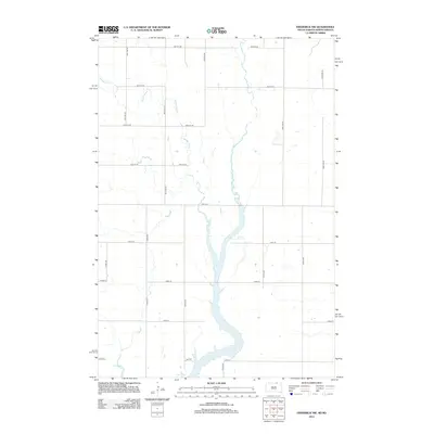
2012 Map of Frederick NW
USGS Topo · Published 2012About this map
Elm Lake and the Elm River dominate this borderland landscape between North and South Dakota. The topography is defined by the winding course of the river as it flows south toward the lake, carving a distinct valley through the prairie. This 2012 survey illustrates the modern agricultural grid system of the Great Plains, where section-line roads such as 100th St SE and 375th Ave dictate the movement of commerce and travel. The drainage patterns of Webber Gulch feed into the river system, highlighting the natural hydrology that has influenced settlement patterns in Elm Township for over a century. The map provides a clear view of the rural infrastructure, showing scattered farmsteads and the network of local roads that connect this remote farming region.
Find a feature on this map
23 named features on this map. Tap any name to fly to it.
Don’t see what you’re looking for? This feature index may not catch every label — zoom into the map to look around manually.
Map Details
Editions of this 2012 Frederick NW Map
This is the sole edition of this map. No revisions or reprints were ever made.
Other maps of this area

1894 · Monango
USGS Topo · 1:62,500

1894 · Ellendale
USGS Topo · 1:62,500

1896 · Edgeley
USGS Topo · 1:125,000

1899 · Ellendale
USGS Topo · 1:125,000

1925 · Edgeley
USGS Topo · 1:125,000

1953 · Jamestown
USGS Topo · 1:250,000

1953 · Frederick
USGS Topo · 1:24,000

1953 · Ellendale South
USGS Topo · 1:24,000

1954 · Aberdeen
USGS Topo · 1:250,000

1956 · Aberdeen
USGS Topo · 1:250,000