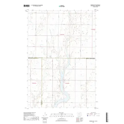
2017 Map of Frederick NW
USGS Topo · Published 2017About this map
Elm Lake and its surrounding wetlands anchor this prairie landscape along the border of North and South Dakota. The topography is defined by the meandering Elm River and Webber Gulch, which cut through the glaciated plains of Dickey County and McPherson County. A primary landmark for local historians is the Aurdal Cem, situated just north of the state line. The road network follows a strict sectional grid, with State Line Rd 102nd St SE serving as the definitive boundary between the two states. Newer residential access points like W Elm Lake Dr and Flying J Dr suggest more recent development around the lakefront compared to the traditional agricultural parcels found throughout the quadrangle.
Find a feature on this map
31 named features on this map. Tap any name to fly to it.
Don’t see what you’re looking for? This feature index may not catch every label — zoom into the map to look around manually.
Map Details
Editions of this 2017 Frederick NW Map
This is the sole edition of this map. No revisions or reprints were ever made.
Other maps of this area

1894 · Monango
USGS Topo · 1:62,500

1894 · Ellendale
USGS Topo · 1:62,500

1896 · Edgeley
USGS Topo · 1:125,000

1899 · Ellendale
USGS Topo · 1:125,000

1925 · Edgeley
USGS Topo · 1:125,000

1953 · Jamestown
USGS Topo · 1:250,000

1953 · Frederick
USGS Topo · 1:24,000

1953 · Ellendale South
USGS Topo · 1:24,000

1954 · Aberdeen
USGS Topo · 1:250,000

1956 · Aberdeen
USGS Topo · 1:250,000