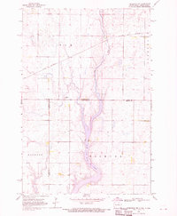
1968 Map of Frederick NW
USGS Topo · Published 1970About this map
Elm Lake dominates the central landscape of this 1968 survey, where the Elm River is regulated by a managed Spillway Elevation 1458. This borderland region, straddling the line between North Dakota and South Dakota, reflects a deeply rooted rural infrastructure of township governance and community faith. Traces of early prairie life are visible through scattered landmarks such as the Aurdal Ch, an old Cem, and multiple locations labeled Townhall.
Find a feature on this map
14 named features on this map. Tap any name to fly to it.
Don’t see what you’re looking for? This feature index may not catch every label — zoom into the map to look around manually.
Map Details
Editions of this 1968 Frederick NW Map
This is the sole edition of this map. No revisions or reprints were ever made.
Other maps of this area

1894 · Monango
USGS Topo · 1:62,500

1894 · Ellendale
USGS Topo · 1:62,500

1896 · Edgeley
USGS Topo · 1:125,000

1899 · Ellendale
USGS Topo · 1:125,000

1925 · Edgeley
USGS Topo · 1:125,000

1953 · Jamestown
USGS Topo · 1:250,000

1953 · Frederick
USGS Topo · 1:24,000

1953 · Ellendale South
USGS Topo · 1:24,000

1954 · Aberdeen
USGS Topo · 1:250,000

1956 · Aberdeen
USGS Topo · 1:250,000