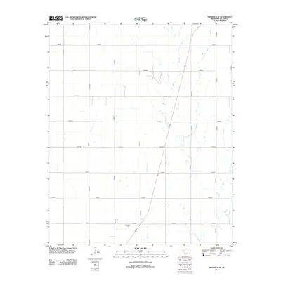
2012 Map of Frederick SE
USGS Topo · Published 2012About this map
Davidson Cem serves as a primary historical marker in this agricultural landscape of Tillman County, situated near the intersection of E1900 Rd and N2180 Rd. The terrain is defined by the drainage patterns of Suttle Cr and Bottle Cr, which wind across a strictly gridded section-line road system. This network of rural routes, including N2190 Rd and E1870 Rd, illustrates the persistent land-use patterns of the Oklahoma plains. The map reflects a quiet, rural character where the natural hydrology of the creeks intersects with the precise geometric division of the land typical of early 21st-century agricultural districts.
Find a feature on this map
18 named features on this map. Tap any name to fly to it.
Don’t see what you’re looking for? This feature index may not catch every label — zoom into the map to look around manually.
Map Details
Editions of this 2012 Frederick SE Map
This is the sole edition of this map. No revisions or reprints were ever made.
Other maps of this area

1955 · Lawton
USGS Topo · 1:250,000

1958 · Davidson
USGS Topo · 1:62,500

1958 · Frederick
USGS Topo · 1:62,500

1958 · Electra
USGS Topo · 1:62,500

1974 · Hollister NW
USGS Topo · 1:24,000

1974 · Hackberry Flat
USGS Topo · 1:24,000

1975 · Frederick NE
USGS Topo · 1:24,000

1975 · Frederick SW
USGS Topo · 1:24,000

1975 · Frederick NW
USGS Topo · 1:24,000

1975 · Frederick SE
USGS Topo · 1:24,000