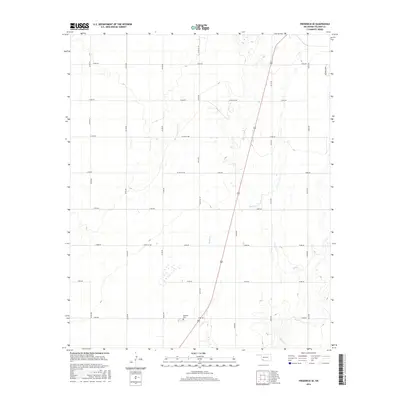
2016 Map of Frederick SE
USGS Topo · Published 2016About this map
Davidson Cem serves as a primary historical anchor in this section of Tillman County, situated near the intersection of N2190 Rd and E1900 Rd. The landscape is defined by the drainage patterns of Bottle Cr and Suttle Cr, which cut through a strictly organized grid of county roads. This network, including Co Rd NS 219 and Co Rd EW 184, reflects the rural land division typical of the Oklahoma plains. The presence of the George Gobel landmark in the northeastern corner suggests localized land use or ownership patterns that stand out against the repetitive road numbering. These features, combined with the prominent path of Highway 183, illustrate a transition from traditional agricultural foundations to modern transit corridors.
Find a feature on this map
25 named features on this map. Tap any name to fly to it.
Don’t see what you’re looking for? This feature index may not catch every label — zoom into the map to look around manually.
Map Details
Editions of this 2016 Frederick SE Map
This is the sole edition of this map. No revisions or reprints were ever made.
Other maps of this area

1955 · Lawton
USGS Topo · 1:250,000

1958 · Davidson
USGS Topo · 1:62,500

1958 · Frederick
USGS Topo · 1:62,500

1958 · Electra
USGS Topo · 1:62,500

1974 · Hollister NW
USGS Topo · 1:24,000

1974 · Hackberry Flat
USGS Topo · 1:24,000

1975 · Frederick NE
USGS Topo · 1:24,000

1975 · Frederick SW
USGS Topo · 1:24,000

1975 · Frederick NW
USGS Topo · 1:24,000

1975 · Frederick SE
USGS Topo · 1:24,000