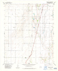
1984 Map of Frederick SE
USGS Topo · Published 1985About this map
The Red River corridor in Tillman County defines this 1984 survey, where the river's winding path forms the southern boundary of the Oklahoma landscape. The region is characterized by a sparse agricultural and industrial layout, with the Burlington Northern railroad cutting a sharp diagonal line across the terrain. This rail corridor connects the northern and southern portions of the map, passing near localized landmarks such as Roadside Park.
Find a feature on this map
13 named features on this map. Tap any name to fly to it.
Don’t see what you’re looking for? This feature index may not catch every label — zoom into the map to look around manually.
Map Details
Editions of this 1984 Frederick SE Map
This is the sole edition of this map. No revisions or reprints were ever made.
Other maps of this area

1955 · Lawton
USGS Topo · 1:250,000

1958 · Davidson
USGS Topo · 1:62,500

1958 · Frederick
USGS Topo · 1:62,500

1958 · Electra
USGS Topo · 1:62,500

1974 · Hollister NW
USGS Topo · 1:24,000

1974 · Hackberry Flat
USGS Topo · 1:24,000

1975 · Frederick NE
USGS Topo · 1:24,000

1975 · Frederick SW
USGS Topo · 1:24,000

1975 · Frederick NW
USGS Topo · 1:24,000

1975 · Frederick SE
USGS Topo · 1:24,000