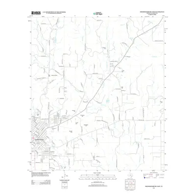
2012 Map of Fredericksburg East
USGS Topo · Published 2012About this map
The eastern expansion of Fredericksburg meets the rising terrain of the Texas Hill Country in this early 21st-century record. The landscape is defined by its numerous named summits and family landmarks, including Kneese Hill, Schuetzen Hill, and the Kordzik Hills that ring the town's perimeter. This era shows the developed street grid of the city center transitioning into a network of ranch roads and lanes, such as Ranch Road 965 and Koennecke Eckhardt Rd. Local history is anchored by the Greenwood Cem and the settlement at Cedarhead. The area's water sources remain central to its layout, with Marschall Spring and Billings Spring feeding into a complex system of creeks like Palo Alto Cr and Marschall Cr. Notable natural features like Balanced Rock on Bear Mtn and the landmark Cross Mtn serve as distinct navigational markers for the region.
Find a feature on this map
146 named features on this map. Tap any name to fly to it.
Don’t see what you’re looking for? This feature index may not catch every label — zoom into the map to look around manually.
Map Details
Editions of this 2012 Fredericksburg East Map
This is the sole edition of this map. No revisions or reprints were ever made.
Other maps of this area

1894 · Fredericksburg
USGS Topo · 1:125,000

1954 · Llano
USGS Topo · 1:250,000

1955 · Llano
USGS Topo · 1:250,000

1956 · Llano
USGS Topo · 1:250,000

1961 · Stonewall
USGS Topo · 1:24,000

1961 · Cave Creek School
USGS Topo · 1:24,000

1963 · Cain City
USGS Topo · 1:24,000

1964 · Oak Crest Park
USGS Topo · 1:24,000
1967 · Cherry Mountain
USGS Topo · 1:24,000

1967 · Fredericksburg East
USGS Topo · 1:24,000