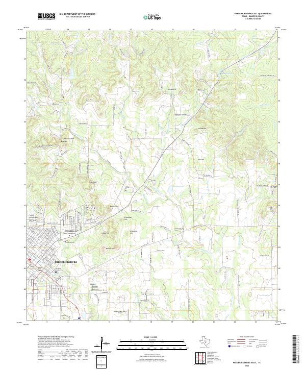
2022 Map of Fredericksburg East
USGS Topo · Published 2022About this map
Fredericksburg serves as the focal point of this Gillespie County landscape, where the town’s grid meets the undulating terrain of the Texas Hill Country. The map records the cultural and civic heart of the community, anchored by the Gillespie County Courthouse and local landmarks such as Der Stadt Friedhof Cem and the Fredericksburg United Methodist Church Columbarium. Outside the central district, the topography is defined by a series of prominent rises including Bear Mtn, known for the Balanced Rock geological feature, and Cross Mtn on the western edge.
Find a feature on this map
161 named features on this map. Tap any name to fly to it.
Don’t see what you’re looking for? This feature index may not catch every label — zoom into the map to look around manually.
Map Details
Editions of this 2022 Fredericksburg East Map
This is the sole edition of this map. No revisions or reprints were ever made.
Other maps of this area

1894 · Fredericksburg
USGS Topo · 1:125,000

1954 · Llano
USGS Topo · 1:250,000

1955 · Llano
USGS Topo · 1:250,000

1956 · Llano
USGS Topo · 1:250,000

1961 · Stonewall
USGS Topo · 1:24,000

1961 · Cave Creek School
USGS Topo · 1:24,000

1963 · Cain City
USGS Topo · 1:24,000

1964 · Oak Crest Park
USGS Topo · 1:24,000
1967 · Cherry Mountain
USGS Topo · 1:24,000

1967 · Fredericksburg East
USGS Topo · 1:24,000