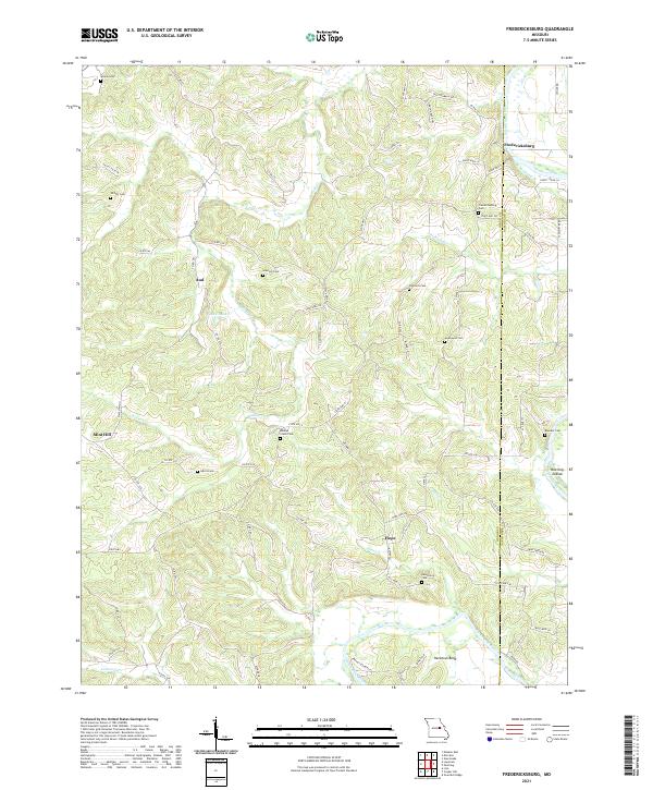
2021 Map of Fredericksburg
USGS Topo · Published 2021About this map
Fredericksburg and Hope anchor this rural landscape where the Gasconade River carves a winding path through the borderlands of Osage and Gasconade counties. The river's influence is central to the local geography, visible in the wide arc of Heckman Bend and the cluster of Koelling Islands downstream. These water features, along with smaller tributaries like Baileys Cr and Richland Cr, dictate the placement of early settlements and family farmsteads throughout the region.
Find a feature on this map
73 named features on this map. Tap any name to fly to it.
Don’t see what you’re looking for? This feature index may not catch every label — zoom into the map to look around manually.
Map Details
Editions of this 2021 Fredericksburg Map
This is the sole edition of this map. No revisions or reprints were ever made.
Other maps of this area

1890 · Fulton
USGS Topo · 1:125,000

1934 · Linn
USGS Topo · 1:48,000

1934 · Bland
USGS Topo · 1:62,500

1935 · Morrison
USGS Topo · 1:48,000

1937 · Bland
USGS Topo · 1:62,500

1942 · Linn
USGS Topo · 1:62,500

1942 · Morrison
USGS Topo · 1:62,500

1945 · Mokane
USGS Topo · 1:62,500

1945 · Morrison
USGS Topo · 1:62,500

1945 · Linn
USGS Topo · 1:62,500