
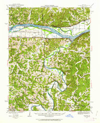
1942 Map of Morrison
USGS Topo · Published 1961About this map
The Missouri River and Gasconade River dominate this 1942 landscape, where river-bottom agriculture and upland topography meet. Along the northern bank of the Missouri, the Missouri Pacific railroad connects riverside towns like Morrison and Gasconade to the wider region. The map captures a transition in river transportation, documenting active river crossings such as Feigler Ferry, Brown Shanty Ferry, and Krueger Ford along the Gasconade and its tributaries.
Find a feature on this map
81 named features on this map. Tap any name to fly to it.
Don’t see what you’re looking for? This feature index may not catch every label — zoom into the map to look around manually.
Map Details
Editions of this 1942 Morrison Map
2 editions found
Other maps of this area

1890 · Hermann
USGS Topo · 1:125,000

1890 · Fulton
USGS Topo · 1:125,000

1903 · Sullivan
USGS Topo · 1:125,000

1928 · Fulton
USGS Topo · 1:62,500

1931 · Fulton
USGS Topo · 1:62,500

1934 · Linn
USGS Topo · 1:48,000

1934 · Bland
USGS Topo · 1:62,500

1935 · Gerald
USGS Topo · 1:48,000

1935 · Morrison
USGS Topo · 1:48,000

1936 · Hermann
USGS Topo · 1:48,000