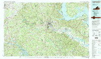
1983 Map of Fredericksburg
USGS Topo · Published 1984About this map
The Rappahannock River and Rapidan River converge near Fredericksburg, a region defined by its significant military and transportation history. This early 1980s data illustrates the extensive boundaries of the Fredericksburg-Spotsylvania National Military Park, marking the hallowed ground of Chancellorsville and Wilderness. To the east, the Potomac River forms the border with Maryland, where the U.S. Naval Res at Dahlgren and the Fort A.P. Hill Military Reservation occupy large portions of the tidewater landscape. The map captures the transition from the rolling hills of Culpeper and Mount Pony in the west to the low-lying necks of the King George area. Key infrastructure of the era is evident, including the Richmond Fredericksburg & Potomac RR and the Southern Railway corridors, alongside the burgeoning development around Lake Anna in the southwest.
Find a feature on this map
83 named features on this map. Tap any name to fly to it.
Don’t see what you’re looking for? This feature index may not catch every label — zoom into the map to look around manually.
Map Details
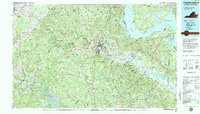
Editions of this 1983 Fredericksburg Map
2 editions found
Other maps of this area

1887 · Spottsylvania
USGS Topo · 1:125,000

1889 · Fredericksburg
USGS Topo · 1:125,000

1890 · Goochland
USGS Topo · 1:125,000

1890 · Mt. Vernon
USGS Topo · 1:125,000

1891 · Palmyra
USGS Topo · 1:125,000

1891 · Mt. Vernon
USGS Topo · 1:125,000

1892 · Fredericksburg
USGS Topo · 1:125,000

1892 · Spottsylvania
USGS Topo · 1:125,000

1892 · Goochland
USGS Topo · 1:125,000

1892 · Brandywine
USGS Topo · 1:62,500