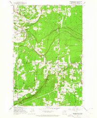
1959 Map of Frederickson
USGS Topo · Published 1964About this map
Frederickson and Graham anchor this 1959 survey of south-central Pierce County, where timbered tracts meet industrial and recreational development. The transportation network is defined by the Chicago Milwaukee St Paul and Pacific railroad, which cuts a diagonal path through the landscape, and a series of rural arteries like Brookdale Road East and Salsich Road. The presence of the Chemical Works and a prominent Substation near Frederickson suggests the area's mid-century industrial role, while the Ft Lewis Mil Res border along the southwestern edge indicates the pervasive military footprint in the region.
Find a feature on this map
36 named features on this map. Tap any name to fly to it.
Don’t see what you’re looking for? This feature index may not catch every label — zoom into the map to look around manually.
Map Details
Editions of this 1959 Frederickson Map
3 editions found
Other maps of this area

1897 · Tacoma
USGS Topo · 1:125,000

1900 · Tacoma
USGS Topo · 1:125,000

1937 · Eatonville
USGS Topo · 1:125,000

1941 · Tanwax Lake
USGS Topo · 1:62,500

1941 · Tacoma South
USGS Topo · 1:62,500

1942 · Lake Tapps
USGS Topo · 1:62,500

1944 · Lake Tapps
USGS Topo · 1:62,500

1944 · Tacoma South
USGS Topo · 1:62,500

1944 · Ohop Valley
USGS Topo · 1:62,500

1949 · Ohop Valley
USGS Topo · 1:62,500