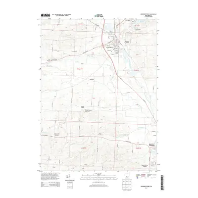
2013 Map of Fredericktown
USGS Topo · Published 2013About this map
Fredericktown and the surrounding agricultural valleys of Knox County are defined by a complex network of tributaries feeding the Kokosing River. This landscape preserves ancient history through notable earthworks like Braddock Mound and Rowley Mound near the town center, contrasting with the late-19th and early-20th-century settlement patterns of Dorema and Dalrymple Corners. The survey meticulously documents local genealogy sites, including the Old Fredericktown Cem and the Green Valley Methodist Protestant Cem. These burial grounds and small communities like Green Valley are linked by a grid of rural routes such as Old Delaware Rd and Mount Gilead Rd. To the north, Knox Lake and its surrounding bays like South Bay mark the transition toward more open water and recreational features, while the southern edge of the map begins to capture the residential expansion of Mount Vernon.
Find a feature on this map
92 named features on this map. Tap any name to fly to it.
Don’t see what you’re looking for? This feature index may not catch every label — zoom into the map to look around manually.
Map Details
Editions of this 2013 Fredericktown Map
This is the sole edition of this map. No revisions or reprints were ever made.
Other maps of this area

1912 · Gambier
USGS Topo · 1:62,500

1912 · Perrysville
USGS Topo · 1:62,500

1914 · Gambier
USGS Topo · 1:62,500

1915 · Perrysville
USGS Topo · 1:62,500

1915 · Shauck
USGS Topo · 1:62,500

1915 · Fredericktown
USGS Topo · 1:62,500

1943 · Shauck
USGS Topo · 1:62,500

1943 · Gambier
USGS Topo · 1:62,500

1943 · Fredericktown
USGS Topo · 1:62,500

1944 · Perrysville
USGS Topo · 1:62,500