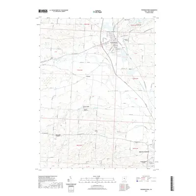
2019 Map of Fredericktown
USGS Topo · Published 2019About this map
Fredericktown serves as the central hub of this Knox County landscape, where the Kokosing River and its various branches create a complex drainage system through the township lands. The presence of Braddock Mound and Rowley Mound points to the ancient indigenous earthworks common to this part of Ohio, while numerous rural cemeteries such as Forest Cem and Old Fredericktown Cem provide deep roots for genealogical research. The map documents a transition from the structured street grid of Mount Vernon and South Mount Vernon at the southern edge to more dispersed rural settlements like Green Valley and Dorema. Local landmarks including Wayne Baptist Ch and Liberty Chapel Cem are anchored along a network of established routes like Old Delaware Rd and Mount Gilead Rd, illustrating the persistence of small community centers across the agricultural countryside.
Find a feature on this map
63 named features on this map. Tap any name to fly to it.
Don’t see what you’re looking for? This feature index may not catch every label — zoom into the map to look around manually.
Map Details
Editions of this 2019 Fredericktown Map
This is the sole edition of this map. No revisions or reprints were ever made.
Other maps of this area

1912 · Gambier
USGS Topo · 1:62,500

1912 · Perrysville
USGS Topo · 1:62,500

1914 · Gambier
USGS Topo · 1:62,500

1915 · Perrysville
USGS Topo · 1:62,500

1915 · Shauck
USGS Topo · 1:62,500

1915 · Fredericktown
USGS Topo · 1:62,500

1943 · Shauck
USGS Topo · 1:62,500

1943 · Gambier
USGS Topo · 1:62,500

1943 · Fredericktown
USGS Topo · 1:62,500

1944 · Perrysville
USGS Topo · 1:62,500