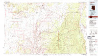
1984 Map of Fredonia
USGS Topo · Published 1984About this map
The high desert landscape of the Arizona Strip is defined here by the towering Vermilion Cliffs and the deep incisions of the Kaibab Plateau. The northern boundary of the Grand Canyon National Park meets the Grand Canyon National Game Preserve, showcasing a remote region where water sources like Jacob Lake and scattered stock wells including Brinkerhoff Well and Gudger Well were vital to survival and land use.
Find a feature on this map
72 named features on this map. Tap any name to fly to it.
Don’t see what you’re looking for? This feature index may not catch every label — zoom into the map to look around manually.
Map Details
Editions of this 1984 Fredonia Map
2 editions found
Other maps of this area

1885 · St. George
USGS Topo · 1:250,000

1886 · Kanab
USGS Topo · 1:250,000

1886 · Escalante
USGS Topo · 1:250,000

1886 · Mt. Trumbull
USGS Topo · 1:250,000

1886 · Echo Cliffs
USGS Topo · 1:250,000

1886 · Kaibab
USGS Topo · 1:250,000

1891 · St. George
USGS Topo · 1:250,000

1891 · Echo Cliffs
USGS Topo · 1:250,000

1892 · Mt. Trumbull
USGS Topo · 1:250,000

1936 · Jacobs Lake
USGS Topo · 1:48,000