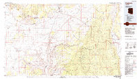
1984 Map of Fredonia
USGS Topo · Published 1984About this map
Fredonia and the Kaibab Indian Reservation anchor this mid-1980s landscape at the edge of the Arizona Strip. The map illustrates a high-desert environment defined by dramatic elevation changes, moving from the Moccasin Mountains and the Vermilion Cliffs down toward the northern reaches of Grand Canyon National Park. Historically significant sites like Pipe Spring National Monument appear alongside small settlements like Moccasin and Colorado City.
Find a feature on this map
88 named features on this map. Tap any name to fly to it.
Don’t see what you’re looking for? This feature index may not catch every label — zoom into the map to look around manually.
Map Details
Editions of this 1984 Fredonia Map
2 editions found
Other maps of this area

1885 · St. George
USGS Topo · 1:250,000

1886 · Kanab
USGS Topo · 1:250,000

1886 · Escalante
USGS Topo · 1:250,000

1886 · Mt. Trumbull
USGS Topo · 1:250,000

1886 · Echo Cliffs
USGS Topo · 1:250,000

1886 · Kaibab
USGS Topo · 1:250,000

1891 · St. George
USGS Topo · 1:250,000

1891 · Echo Cliffs
USGS Topo · 1:250,000

1892 · Mt. Trumbull
USGS Topo · 1:250,000

1936 · Jacobs Lake
USGS Topo · 1:48,000