
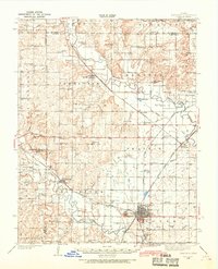
1938 Map of Fredonia
USGS Topo · Published 1965About this map
Fredonia serves as the regional hub of this 1930s landscape, positioned at the convergence of the Atchison Topeka and Santa Fe, St Louis - San Francisco, and Missouri Pacific railroads. The terrain is defined by the winding courses of the Verdigris River and Fall River, which carve through the plains near distinctive landmarks like West Mound and South Mound.
Find a feature on this map
84 named features on this map. Tap any name to fly to it.
Don’t see what you’re looking for? This feature index may not catch every label — zoom into the map to look around manually.
Map Details
Editions of this 1938 Fredonia Map
2 editions found
Other maps of this area

1885 · Eureka
USGS Topo · 1:125,000

1885 · Sedan
USGS Topo · 1:125,000

1886 · Fredonia
USGS Topo · 1:125,000

1886 · Independence
USGS Topo · 1:125,000

1888 · Eureka
USGS Topo · 1:125,000

1889 · Sedan
USGS Topo · 1:125,000

1894 · Fredonia
USGS Topo · 1:125,000

1894 · Independence
USGS Topo · 1:125,000

1894 · Eureka
USGS Topo · 1:125,000

1905 · Independence
USGS Topo · 1:125,000