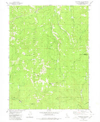
1980 Map of Fredonyer Pass
USGS Topo · Published 1980About this map
Lassen National Forest terrain dominates this 1980 survey, where the watershed of Willard Creek and its many forks carve a path through the high peaks of the Sierra Nevada. The map documents a landscape defined by significant elevations, including Hamilton Mountain, Coyote Peak, and the namesake Fredonyer Pass. While largely undeveloped, the sheet reveals traces of seasonal land use and ranching history at Stephens Ranch and the identified location of Flemings Sheep Camp (Site).
Find a feature on this map
21 named features on this map. Tap any name to fly to it.
Don’t see what you’re looking for? This feature index may not catch every label — zoom into the map to look around manually.
Map Details
Editions of this 1980 Fredonyer Pass Map
This is the sole edition of this map. No revisions or reprints were ever made.
Other maps of this area

1886 · Honey Lake
USGS Topo · 1:250,000

1891 · Honey Lake
USGS Topo · 1:250,000

1893 · Honey Lake
USGS Topo · 1:250,000

1950 · Kettle Rock
USGS Topo · 1:62,500

1950 · Greenville
USGS Topo · 1:62,500

1954 · Susanville
USGS Topo · 1:62,500

1955 · Westwood
USGS Topo · 1:62,500

1955 · Westwood
USGS Topo · 1:250,000

1958 · Westwood
USGS Topo · 1:250,000

1959 · Westwood
USGS Topo · 1:250,000