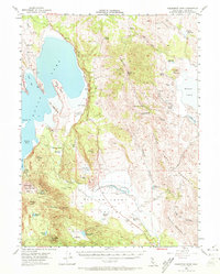
1954 Map of Fredonyer Peak
USGS Topo · Published 1972About this map
Fredonyer Peak dominates the central divide of this Lassen County landscape, separating the vast basin of Eagle Lake from the Horse Lake area. This 1954 survey captures a high-country ranching and forestry economy within the Lassen Nat For, where isolated outposts like Stone Ranch, Woods Ranch, and the Five Dot Ranch are connected by forest roads and trails. The terrain shows evidence of environmental change and management, most notably the Gallatin Burn near Gallatin Peak and the presence of numerous small water catchments like Summit Lake and Hagata Reservoir.
Find a feature on this map
53 named features on this map. Tap any name to fly to it.
Don’t see what you’re looking for? This feature index may not catch every label — zoom into the map to look around manually.
Map Details
Editions of this 1954 Fredonyer Peak Map
3 editions found
Other maps of this area

1886 · Honey Lake
USGS Topo · 1:250,000

1891 · Honey Lake
USGS Topo · 1:250,000

1893 · Honey Lake
USGS Topo · 1:250,000

1954 · Susanville
USGS Topo · 1:62,500

1954 · Litchfield
USGS Topo · 1:62,500

1954 · Karlo
USGS Topo · 1:62,500

1954 · Grasshopper Valley
USGS Topo · 1:62,500

1954 · Ravendale
USGS Topo · 1:62,500

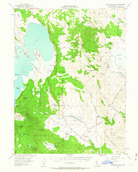
1954 · Fredonyer Peak
USGS Topo · 1:62,500

1955 · Westwood
USGS Topo · 1:62,500