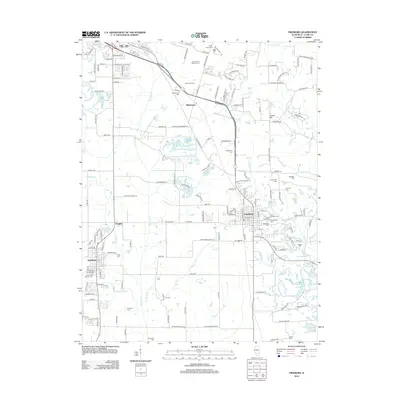
2012 Map of Freeburg
USGS Topo · Published 2012About this map
Freeburg and Smithton serve as the primary anchors for this region south of Belleville, connected by a network of drainage basins and agricultural lands. The landscape is defined by the winding course of Richland Cr and Sugar Cr, which drain the undulating terrain surrounding Turkey Hill. For genealogists, the map is a dense resource, identifying numerous legacy burial sites such as the Wilderman Cem, Saint Josephs Cem, and Reinheimer Cem. Settlement patterns follow the Illinois Central RR corridor, which passes through Wilderman and Freeburg, while agrarian history is marked by the presence of Eckert Orchards. The abundance of smaller cemeteries like Hamann Cem and Carr Cem reflects the deep-rooted family farmsteads that once dominated the Saint Clair County countryside.
Find a feature on this map
154 named features on this map. Tap any name to fly to it.
Don’t see what you’re looking for? This feature index may not catch every label — zoom into the map to look around manually.
Map Details
Editions of this 2012 Freeburg Map
This is the sole edition of this map. No revisions or reprints were ever made.
Other maps of this area

1888 · St. Louis
USGS Topo · 1:62,500

1907 · Belleville
USGS Topo · 1:62,500

1910 · Waterloo
USGS Topo · 1:62,500

1912 · New Athens
USGS Topo · 1:62,500

1913 · Waterloo
USGS Topo · 1:62,500

1931 · French Village
USGS Topo · 1:24,000

1935 · Lebanon
USGS Topo · 1:24,000

1935 · French Village
USGS Topo · 1:24,000

1937 · O'Fallon
USGS Topo · 1:24,000

1949 · Saint Louis
USGS Topo · 1:250,000