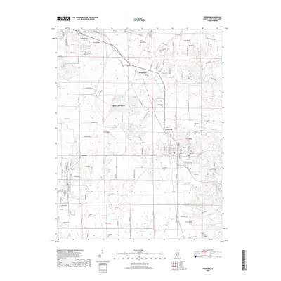
2018 Map of Freeburg
USGS Topo · Published 2018About this map
Turkey Hill and the surrounding agricultural landscapes of Saint Clair County dominate this geographic study. The terrain is defined by the branching waters of Richland Cr, Sugar Cr, and Jacks Run, which carve through the countryside between the growing hubs of Belleville, Freeburg, and Smithton. This record is particularly valuable for genealogists, as it meticulously identifies numerous small family and community burial grounds, including the Rittenhouse Cem, Wilderman Cem, and Foulkes Cem. Smaller locales like Stolberg and Wilderman appear alongside established landmarks such as Turkey Hill Lake and Biebell Lake. The road network shows a transition from rural routes like Blacksmith Shop Rd and Hill Mine Rd to modern residential developments, illustrating the evolving land use in this part of Southern Illinois.
Find a feature on this map
96 named features on this map. Tap any name to fly to it.
Don’t see what you’re looking for? This feature index may not catch every label — zoom into the map to look around manually.
Map Details
Editions of this 2018 Freeburg Map
This is the sole edition of this map. No revisions or reprints were ever made.
Other maps of this area

1888 · St. Louis
USGS Topo · 1:62,500

1907 · Belleville
USGS Topo · 1:62,500

1910 · Waterloo
USGS Topo · 1:62,500

1912 · New Athens
USGS Topo · 1:62,500

1913 · Waterloo
USGS Topo · 1:62,500

1931 · French Village
USGS Topo · 1:24,000

1935 · Lebanon
USGS Topo · 1:24,000

1935 · French Village
USGS Topo · 1:24,000

1937 · O'Fallon
USGS Topo · 1:24,000

1949 · Saint Louis
USGS Topo · 1:250,000