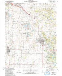
1990 Map of Freeburg
USGS Topo · Published 1991About this map
The town of Freeburg and the surrounding St. Clair County landscape are defined by a complex network of small streams and coal-related infrastructure as they appeared in the late 1980s. The Illinois Central Gulf Railroad cuts diagonally across the terrain, passing through the village of Wilderman and providing a transport corridor through the central valley. Significant for local genealogy, the area is dotted with family-named burial grounds like Reinheimer Cem and Schaefer Cem, alongside larger sites such as Green Mount Cem near the southern edge of Belleville.
Find a feature on this map
81 named features on this map. Tap any name to fly to it.
Don’t see what you’re looking for? This feature index may not catch every label — zoom into the map to look around manually.
Map Details
Editions of this 1990 Freeburg Map
This is the sole edition of this map. No revisions or reprints were ever made.
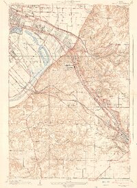
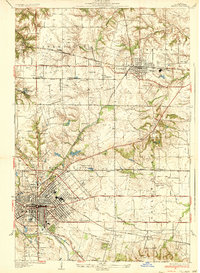
Other maps of this area

1888 · St. Louis
USGS Topo · 1:62,500

1907 · Belleville
USGS Topo · 1:62,500

1910 · Waterloo
USGS Topo · 1:62,500

1912 · New Athens
USGS Topo · 1:62,500

1913 · Waterloo
USGS Topo · 1:62,500

1931 · French Village
USGS Topo · 1:24,000
1935 · Lebanon
USGS Topo · 1:24,000
1935 · French Village
USGS Topo · 1:24,000
1937 · O'Fallon
USGS Topo · 1:24,000

1949 · Saint Louis
USGS Topo · 1:250,000