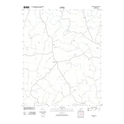
2010 Map of Freedom
USGS Topo · Published 2010About this map
Skaggs Creek and Nobob Creek define the drainage of this Barren County landscape, where small agricultural settlements and family burial grounds dot the terrain. The map captures the quiet rural character of south-central Kentucky, centered around the crossroads at Mount Hermon and the northern village of Nobob. Genealogists will find this particular sheet indispensable due to the high density of small family and community cemeteries, including Atkinson Cemetery, Lyon Cemetery, and Freedom Cemetery. The winding road network, including names like Antioch Church Rd and Bethlehem Church Rd, suggests a community long organized around its local parishes. In the south, Mud Lick and Jeffrey mark the southern reach of this survey, where Peter Creek and its various tributaries like Cable Branch flow toward the county line.
Find a feature on this map
72 named features on this map. Tap any name to fly to it.
Don’t see what you’re looking for? This feature index may not catch every label — zoom into the map to look around manually.
Map Details
Editions of this 2010 Freedom Map
This is the sole edition of this map. No revisions or reprints were ever made.
Other maps of this area

1929 · Tompkinsville
USGS Topo · 1:62,500

1931 · Red Boiling Springs
USGS Topo · 1:62,500

1953 · Tracy
USGS Topo · 1:24,000

1953 · Sulphur Lick
USGS Topo · 1:24,000

1953 · Temple Hill
USGS Topo · 1:24,000

1953 · Glasgow South
USGS Topo · 1:24,000

1953 · Freedom
USGS Topo · 1:24,000

1953 · Summer Shade
USGS Topo · 1:24,000

1954 · Fountain Run
USGS Topo · 1:24,000

1954 · Gamaliel
USGS Topo · 1:24,000