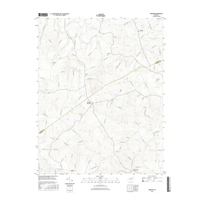
2016 Map of Freedom
USGS Topo · Published 2016About this map
Mount Hermon serves as a central hub in this corner of the Kentucky highlands, where the boundary between Barren Co and Monroe Co cuts through a landscape of winding creek beds and family cemeteries. The rural character of the region is defined by its dispersed settlements like Nobob and Mud Lick, connected by a network of named roads such as Ritters Mill Rd and Poplar School Rd. This 2016 survey illustrates the persistent agricultural and residential patterns of the area, where small family plots like Simmons Cem and Bowles Cem dot the ridges above the many branches of Skaggs Creek. The concentration of sites like Freedom Cem and Jeffrey suggests a deeply rooted community history tied to the local topography of hollows and forks.
Find a feature on this map
93 named features on this map. Tap any name to fly to it.
Don’t see what you’re looking for? This feature index may not catch every label — zoom into the map to look around manually.
Map Details
Editions of this 2016 Freedom Map
This is the sole edition of this map. No revisions or reprints were ever made.
Other maps of this area

1929 · Tompkinsville
USGS Topo · 1:62,500

1931 · Red Boiling Springs
USGS Topo · 1:62,500

1953 · Tracy
USGS Topo · 1:24,000

1953 · Sulphur Lick
USGS Topo · 1:24,000

1953 · Temple Hill
USGS Topo · 1:24,000

1953 · Glasgow South
USGS Topo · 1:24,000

1953 · Freedom
USGS Topo · 1:24,000

1953 · Summer Shade
USGS Topo · 1:24,000

1954 · Fountain Run
USGS Topo · 1:24,000

1954 · Gamaliel
USGS Topo · 1:24,000