
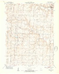
1953 Map of Freeman
USGS Topo · Published 1954About this map
Freeman and Lisle anchor this mid-century look at the borderlands between Cass County, Missouri, and Miami County, Kansas. The Kansas City Southern railroad serves as a primary north-south artery, threading through the landscape alongside drainage systems like Coldwater Creek and Horless Creek. The map reveals a highly organized rural society defined by its local institutions, with numerous schoolhouses such as Glendale Sch and Calvert Sch distributed to serve the farming families of West Dolan and Dolan townships.
Find a feature on this map
26 named features on this map. Tap any name to fly to it.
Don’t see what you’re looking for? This feature index may not catch every label — zoom into the map to look around manually.
Map Details
Editions of this 1953 Freeman Map
4 editions found
Other maps of this area

1887 · Harrisonville
USGS Topo · 1:125,000

1887 · Olathe
USGS Topo · 1:125,000

1887 · Butler
USGS Topo · 1:125,000

1887 · Mound City
USGS Topo · 1:125,000

1892 · Harrisonville
USGS Topo · 1:125,000

1893 · Mound City
USGS Topo · 1:125,000

1893 · Olathe
USGS Topo · 1:125,000

1894 · Harrisonville
USGS Topo · 1:125,000

1894 · Butler
USGS Topo · 1:125,000

1947 · Lawrence
USGS Topo · 1:250,000