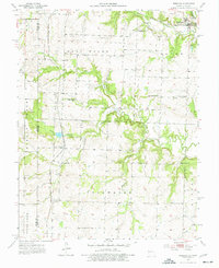
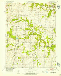
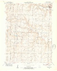
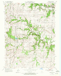
1953 Map of Freeman
USGS Topo · Published 1977About this map
The Kansas City Southern railroad serves as the central artery through this rural landscape on the border of Miami and Cass Counties. Anchored by the settlements of Freeman and Lisle, the area shows a well-established network of community institutions in the mid-20th century. A remarkable number of rural schoolhouses, including Glendale Sch, Van Meter Sch, Dodge Point Sch, Coldwater Sch, and Calvert Sch, are distributed across the terrain, reflecting the decentralized educational structure of the era.
Find a feature on this map
28 named features on this map. Tap any name to fly to it.
Don’t see what you’re looking for? This feature index may not catch every label — zoom into the map to look around manually.
Map Details
Editions of this 1953 Freeman Map
4 editions found
Other maps of this area

1887 · Harrisonville
USGS Topo · 1:125,000

1887 · Olathe
USGS Topo · 1:125,000

1887 · Butler
USGS Topo · 1:125,000

1887 · Mound City
USGS Topo · 1:125,000

1892 · Harrisonville
USGS Topo · 1:125,000

1893 · Mound City
USGS Topo · 1:125,000

1893 · Olathe
USGS Topo · 1:125,000

1894 · Harrisonville
USGS Topo · 1:125,000

1894 · Butler
USGS Topo · 1:125,000

1947 · Lawrence
USGS Topo · 1:250,000