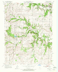
1953 Map of Freeman
USGS Topo · Published 1972About this map
The town of Freeman sits at the intersection of a complex creek network and the Kansas City Southern railroad, serving as a focal point for this rural landscape in the early 1950s. The terrain is defined by the branching tributaries of Middle Creek, Harless Creek, and Coldwater Creek, which carve through the townships of West Dolan and Coldwater. This survey reveals a deeply established rural infrastructure of one-room schoolhouses, including Dodge Point Sch, Van Meter Sch, and Calvert Sch, scattered to serve the farming families of the Miami Co Cass Co border region.
Find a feature on this map
29 named features on this map. Tap any name to fly to it.
Don’t see what you’re looking for? This feature index may not catch every label — zoom into the map to look around manually.
Map Details
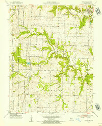
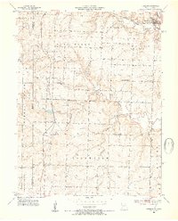
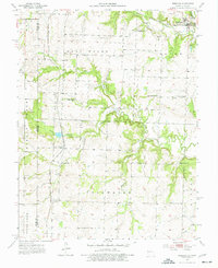
Editions of this 1953 Freeman Map
4 editions found
Other maps of this area

1887 · Harrisonville
USGS Topo · 1:125,000

1887 · Olathe
USGS Topo · 1:125,000

1887 · Butler
USGS Topo · 1:125,000

1887 · Mound City
USGS Topo · 1:125,000

1892 · Harrisonville
USGS Topo · 1:125,000

1893 · Mound City
USGS Topo · 1:125,000

1893 · Olathe
USGS Topo · 1:125,000

1894 · Harrisonville
USGS Topo · 1:125,000

1894 · Butler
USGS Topo · 1:125,000

1947 · Lawrence
USGS Topo · 1:250,000