2021 Map of Freeman
USGS Topo · Published 2021About this map
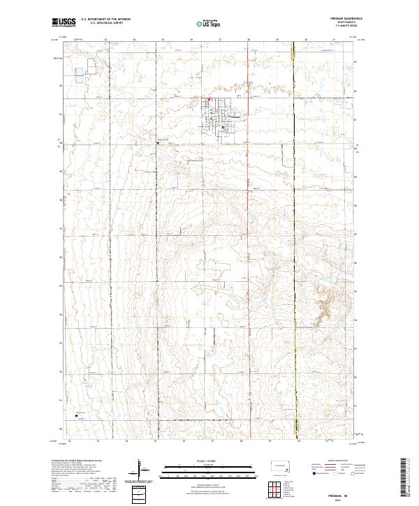
Freeman serves as the primary municipal center for this section of Hutchinson County, shown here with a detailed residential and commercial street grid including S Main St, Cedar St, and E College Ave. The surrounding landscape is defined by the rectilinear section lines of the Public Land Survey System, a hallmark of the Great Plains agricultural layout. Waterways such as Turkey Ridge Cr and Clay Cr cut across these geometric divisions, creating natural drainage patterns that diverge from the rigid road network of 438th Ave and 278th St. Genealogists will find the Freeman Cem and the more isolated Knodel Cem located south of the town center, providing specific points of interest for tracing local family histories in this rural South Dakota township.
Find a feature on this map
45 named features on this map. Tap any name to fly to it.
Don’t see what you’re looking for? This feature index may not catch every label — zoom into the map to look around manually.
Map Details
Editions of this 2021 Freeman Map
This is the sole edition of this map. No revisions or reprints were ever made.
Historical Maps of Valley Township Through Time
3 maps found