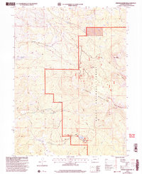
2000 Map of Freeman Reservoir
USGS Topo · Published 2004About this map
Routt National Forest dominates this landscape in the northern Elkhead Mountains, where high peaks like Mount Welba and Mount Oliphant overlook the watersheds of several creeks. The map documents the high-altitude terrain at the turn of the 21st century, centered on water resources like Freeman Reservoir and Martin Gull Reservoir. Evidence of human activity and management is visible in the network of forest roads and the historic Bears Ears Trail. Small settlements or administrative points like Freeman and Sherman sit near the southern edge of the sheet, while a remote Drill Hole and a Communication Site on the slopes of Black Mountain indicate specialized industrial and technological footprints in this isolated region. The drainage patterns are clearly defined by the North Fork Fortification Creek and South Fork Fortification Creek, which carve through the elevations below Sand Point and The Gap.
Find a feature on this map
23 named features on this map. Tap any name to fly to it.
Don’t see what you’re looking for? This feature index may not catch every label — zoom into the map to look around manually.
Map Details
Editions of this 2000 Freeman Reservoir Map
This is the sole edition of this map. No revisions or reprints were ever made.
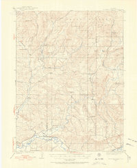
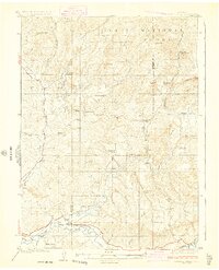
Other maps of this area

1916 · Craig
USGS Topo · 1:125,000
1923 · Elkhead Creek
USGS Topo · 1:62,500
1924 · Elkhead Creek
USGS Topo · 1:62,500

1954 · Craig
USGS Topo · 1:250,000

1957 · Craig
USGS Topo · 1:250,000

1958 · Craig
USGS Topo · 1:250,000

1960 · Craig
USGS Topo · 1:250,000

1962 · Craig
USGS Topo · 1:250,000

1964 · Craig
USGS Topo · 1:250,000

1965 · Craig
USGS Topo · 1:250,000