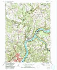
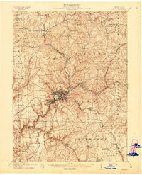
1993 Map of Freeport
USGS Topo · Published 1993About this map
Allegheny River and Kiskiminetas River converge at the heart of this landscape, anchoring the industrial and transport hub of Freeport. The town sits at a critical junction where Conrail tracks follow the riverbanks, serving the valley's established settlements like Laneville and Schenley. Moving away from the river, the terrain rises into the highlands of Winfield and Buffalo townships, where the character of the land shifts toward rural crossroads such as Bricker Crossroads and Nolf Corners.
Find a feature on this map
75 named features on this map. Tap any name to fly to it.
Don’t see what you’re looking for? This feature index may not catch every label — zoom into the map to look around manually.
Map Details
Editions of this 1993 Freeport Map
This is the sole edition of this map. No revisions or reprints were ever made.
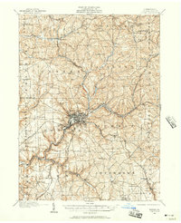
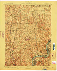
Other maps of this area

1900 · Kittanning
USGS Topo · 1:62,500

1902 · Kittanning
USGS Topo · 1:62,500

1907 · Freeport
USGS Topo · 1:62,500

1908 · New Kensington
USGS Topo · 1:62,500
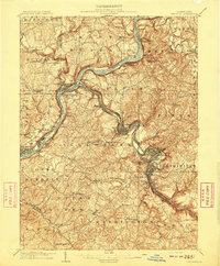
1909 · Freeport
USGS Topo · 1:62,500
1909 · Butler
USGS Topo · 1:62,500
1910 · New Kensington
USGS Topo · 1:62,500
1911 · Butler
USGS Topo · 1:62,500

1953 · Pittsburgh
USGS Topo · 1:250,000
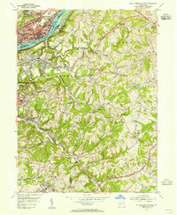
1953 · New Kensington East
USGS Topo · 1:24,000
Featured Places
- Harrison Township, PA
- Freeport, PA
- Buffalo Township, PA
- Winfield Township, PA
- South Buffalo Township, PA