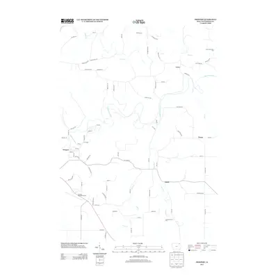
2013 Map of Freeport
USGS Topo · Published 2013About this map
The Upper Iowa River winds through this portion of Winneshiek County, carving a path through the landscape where the small settlements of Freeport and Nasset took root. In the early 21st century, the area maintained a balance of agricultural land and managed conservation areas, notably the Trout River Access Area and the Canoe Creek Access Area. These public access points reflect the enduring importance of the local waterways, including the Trout River and Canoe Cr, for recreation and natural resource management in the Driftless Area.
Find a feature on this map
69 named features on this map. Tap any name to fly to it.
Don’t see what you’re looking for? This feature index may not catch every label — zoom into the map to look around manually.
Map Details
Editions of this 2013 Freeport Map
This is the sole edition of this map. No revisions or reprints were ever made.
Other maps of this area

1906 · Decorah
USGS Topo · 1:125,000

1958 · La Crosse
USGS Topo · 1:250,000

1961 · La Crosse
USGS Topo · 1:250,000

1965 · La Crosse
USGS Topo · 1:250,000
1971 · Dorchester
USGS Topo · 1:24,000
1971 · Frankville
USGS Topo · 1:24,000
1971 · Hanover
USGS Topo · 1:24,000

1975 · Decorah 4 NW
USGS Topo · 1:24,000

1975 · Decorah 1 NW
USGS Topo · 1:24,000

1975 · Decorah 1 SW
USGS Topo · 1:24,000