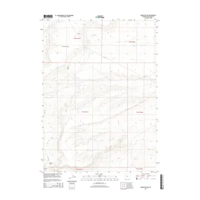
2015 Map of Freighter Gap
USGS Topo · Published 2015About this map
The Continental Divide winds through this high-desert portion of Sweetwater County, shaping a landscape defined by seasonal water sources and steep relief. Sparse but vital hydraulic features like Chicken Springs and Freighter Spring provided necessary stopovers for travelers in this arid region. The topography is marked by significant natural barriers and corridors, most notably the Freighter Gap and the sheer walls of Split Rock Canyon. These landforms dictate the passage of modern unpaved routes such as Bar X Rd and Cr 83, which trace the same paths used by earlier generations of ranchers and westward emigrants. Surveyed by the U.S. Geological Survey, the map documents the intersection of natural hydrology, including Jack Parnell Cr and Bush Cr, with the prominent escarpment of Bush Rim.
Find a feature on this map
16 named features on this map. Tap any name to fly to it.
Don’t see what you’re looking for? This feature index may not catch every label — zoom into the map to look around manually.
Map Details
Editions of this 2015 Freighter Gap Map
This is the sole edition of this map. No revisions or reprints were ever made.
Other maps of this area

1954 · Rock Springs
USGS Topo · 1:250,000

1955 · Lander
USGS Topo · 1:250,000

1958 · Lander
USGS Topo · 1:250,000

1958 · Rock Springs
USGS Topo · 1:250,000

1958 · Twelvemile Well
USGS Topo · 1:62,500

1958 · Freighter Gap
USGS Topo · 1:62,500

1958 · The Pinnacles
USGS Topo · 1:62,500

1958 · Superior
USGS Topo · 1:62,500

1961 · Lander
USGS Topo · 1:250,000

1962 · Rock Springs
USGS Topo · 1:250,000