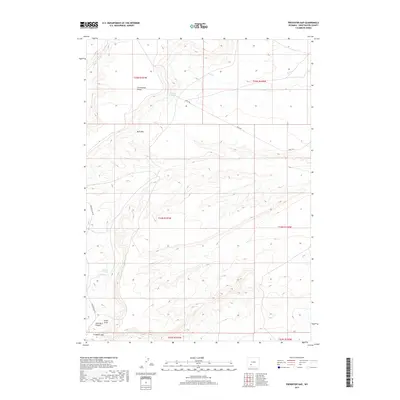
2017 Map of Freighter Gap
USGS Topo · Published 2017About this map
The Continental Divide traverses this high desert landscape in Sweetwater County, marking a critical hydrological boundary in the Wyoming basin. This arid expanse is defined by significant topographic shifts, most notably at Bush Rim and the dramatic incision of Split Rock Canyon. Water sources are few and vital in this environment, represented here by Chicken Springs and Freighter Spring, which historically served as essential stops for travelers crossing the high plains. The drainage network includes seasonal watercourses like Jack Parnell Cr and Bush Cr, which feed into the wider basin floor near Alkali Draw. Local transit is facilitated by unpaved tracks such as Bar X Rd and the namesake Freighter Gap Rd, which snakes through the pass at Freighter Gap. This map illustrates the intersection of natural barriers and the essential trail routes required to navigate them.
Find a feature on this map
17 named features on this map. Tap any name to fly to it.
Don’t see what you’re looking for? This feature index may not catch every label — zoom into the map to look around manually.
Map Details
Editions of this 2017 Freighter Gap Map
This is the sole edition of this map. No revisions or reprints were ever made.
Other maps of this area

1954 · Rock Springs
USGS Topo · 1:250,000

1955 · Lander
USGS Topo · 1:250,000

1958 · Lander
USGS Topo · 1:250,000

1958 · Rock Springs
USGS Topo · 1:250,000

1958 · Twelvemile Well
USGS Topo · 1:62,500

1958 · Freighter Gap
USGS Topo · 1:62,500

1958 · The Pinnacles
USGS Topo · 1:62,500

1958 · Superior
USGS Topo · 1:62,500

1961 · Lander
USGS Topo · 1:250,000

1962 · Rock Springs
USGS Topo · 1:250,000