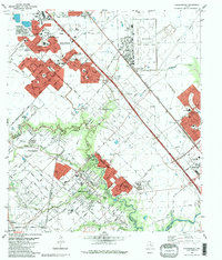
1982 Map of Freindswood
USGS Topo · Published 1983About this map
Ellington Air Force Base dominates the northeastern landscape of this Houston-area survey, surrounded by the sprawling residential development of Houston, Friendswood, and Pearland. The map reveals a suburban environment deeply integrated with the region's petroleum industry, evidenced by the extensive Friendswood Oil Field and Hastings Oil Field that flank the residential cores. Neighborhoods like Wedgewood Village and Forest Bend are nestled among active oil wells and pipeline corridors, highlighting the unique land-use patterns of the Texas Gulf Coast during the early 1980s.
Find a feature on this map
69 named features on this map. Tap any name to fly to it.
Don’t see what you’re looking for? This feature index may not catch every label — zoom into the map to look around manually.
Map Details
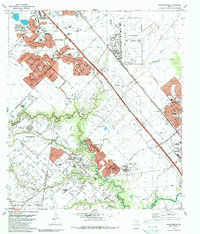
Editions of this 1982 Freindswood Map
2 editions found
Other maps of this area

1915 · Park Place
USGS Topo · 1:24,000

1915 · Deepwater
USGS Topo · 1:24,000

1916 · Genoa
USGS Topo · 1:24,000

1916 · Seabrook
USGS Topo · 1:24,000

1916 · La Porte
USGS Topo · 1:24,000

1919 · Deepwater
USGS Topo · 1:31,680

1920 · Seabrook
USGS Topo · 1:31,680

1920 · Genoa
USGS Topo · 1:31,680

1920 · Mykawa
USGS Topo · 1:31,680

1920 · La Porte
USGS Topo · 1:31,680