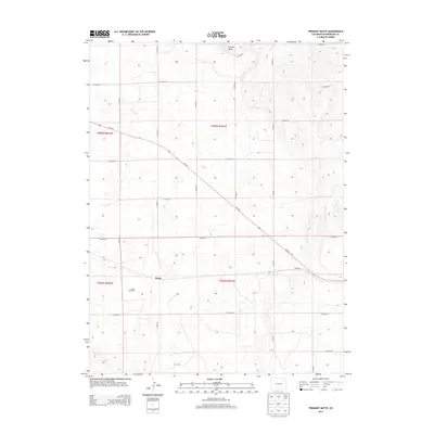
2013 Map of Fremont Butte
USGS Topo · Published 2013About this map
Xenia sits at the heart of this high plains landscape, situated along the diagonal path of Us-34 E. This rural corner of Washington County is defined by a rigid grid of section-line roads, including Co Road V and Co Road 42, which carve the prairie into precise agricultural and resource-rich blocks. The presence of the Xenia Oil Field southwest of the settlement suggests the local economic reliance on energy extraction in addition to traditional ranching and farming.
Find a feature on this map
24 named features on this map. Tap any name to fly to it.
Don’t see what you’re looking for? This feature index may not catch every label — zoom into the map to look around manually.
Map Details
Editions of this 2013 Fremont Butte Map
This is the sole edition of this map. No revisions or reprints were ever made.
Other maps of this area

1951 · Merino SW
USGS Topo · 1:24,000

1951 · Merino SE
USGS Topo · 1:24,000

1954 · Sterling
USGS Topo · 1:250,000

1958 · Sterling
USGS Topo · 1:250,000

1973 · Akron
USGS Topo · 1:24,000

1973 · Rago
USGS Topo · 1:24,000

1973 · Fremont Butte
USGS Topo · 1:24,000

1973 · Pinneo SE
USGS Topo · 1:24,000
1973 · Buffalo Springs Ranch
USGS Topo · 1:24,000
1973 · Pinneo
USGS Topo · 1:24,000