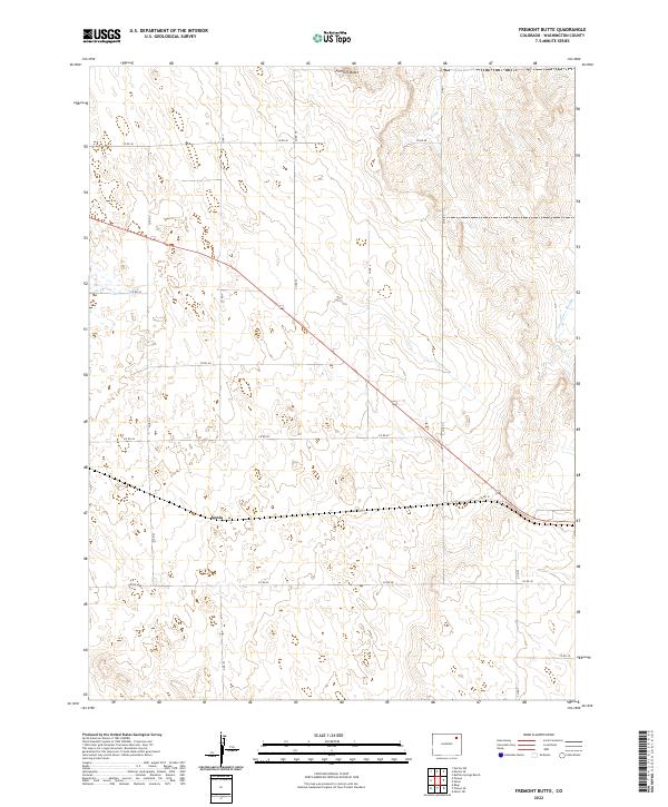
2022 Map of Fremont Butte
USGS Topo · Published 2022About this map
Fremont Butte rises as the prominent geographic landmark in this corner of Washington County, overlooking a landscape defined by the expansive grid of the Public Land Survey System. The small settlement of Xenia sits along the southern edge of the survey, positioned near the intersection of several county thoroughfares including Co Rd 41 and Co RD 42. This modern 2022 survey depicts a quiet ranching and agricultural region where the natural drainage of Twentytwo Slough cuts through the northeast. The map is primarily structured by a network of county roads, such as Co Rd 46 and Co Rd 40, which provide access to the various sections and ranges. The sparse distribution of named features underscores the rural nature of the High Plains, where elevation and water sources like the slough dictate the movement and settlement patterns of the area.
Find a feature on this map
14 named features on this map. Tap any name to fly to it.
Don’t see what you’re looking for? This feature index may not catch every label — zoom into the map to look around manually.
Map Details
Editions of this 2022 Fremont Butte Map
This is the sole edition of this map. No revisions or reprints were ever made.
Other maps of this area

1951 · Merino SW
USGS Topo · 1:24,000

1951 · Merino SE
USGS Topo · 1:24,000

1954 · Sterling
USGS Topo · 1:250,000

1958 · Sterling
USGS Topo · 1:250,000

1973 · Akron
USGS Topo · 1:24,000

1973 · Rago
USGS Topo · 1:24,000

1973 · Fremont Butte
USGS Topo · 1:24,000

1973 · Pinneo SE
USGS Topo · 1:24,000
1973 · Buffalo Springs Ranch
USGS Topo · 1:24,000
1973 · Pinneo
USGS Topo · 1:24,000