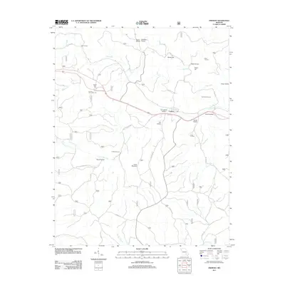
2011 Map of Fremont
USGS Topo · Published 2011About this map
Fremont sits at the heart of this Missouri Ozarks landscape, where the town is surrounded by a complex system of hollows and ridges. The terrain is deeply carved by waterways such as Pike Creek and Little Pike Creek, creating a rugged geography that historically dictated travel and settlement patterns. Several family and community burial sites are scattered throughout the hills, including Clark Cemetery, Midco Cemetery, and Snider Cemetery, providing valuable points of interest for genealogists tracing local families.
Find a feature on this map
39 named features on this map. Tap any name to fly to it.
Don’t see what you’re looking for? This feature index may not catch every label — zoom into the map to look around manually.
Map Details
Editions of this 2011 Fremont Map
This is the sole edition of this map. No revisions or reprints were ever made.
Other maps of this area

1915 · Eminence
USGS Topo · 1:62,500

1917 · Eminence
USGS Topo · 1:62,500

1928 · Cardareva
USGS Topo · 1:62,500

1931 · Bandyville
USGS Topo · 1:48,000

1944 · Van Buren
USGS Topo · 1:62,500

1944 · Birch Tree
USGS Topo · 1:62,500

1946 · Van Buren
USGS Topo · 1:62,500

1948 · Birch Tree
USGS Topo · 1:62,500

1949 · Rolla
USGS Topo · 1:250,000

1949 · Cardareva
USGS Topo · 1:62,500