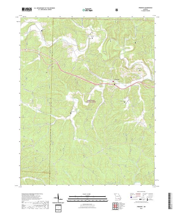
2021 Map of Fremont
USGS Topo · Published 2021About this map
Fremont sits at the heart of this terrain, where the valley of Little Pike Cr meets the larger drainage of Pike Cr. The landscape is defined by the deep incisions of the Mark Twain National Forest, where numerous family and community cemeteries such as Clark Cem, New Hope Cem, and Pleasant Site Cem are tucked away in the hollows and hills. The presence of the Old Tram path south of Fremont hints at the region's historical reliance on timber and light rail for transporting resources through the uneven geography of the Ozarks.
Find a feature on this map
39 named features on this map. Tap any name to fly to it.
Don’t see what you’re looking for? This feature index may not catch every label — zoom into the map to look around manually.
Map Details
Editions of this 2021 Fremont Map
This is the sole edition of this map. No revisions or reprints were ever made.
Other maps of this area

1915 · Eminence
USGS Topo · 1:62,500

1917 · Eminence
USGS Topo · 1:62,500

1928 · Cardareva
USGS Topo · 1:62,500

1931 · Bandyville
USGS Topo · 1:48,000

1944 · Van Buren
USGS Topo · 1:62,500

1944 · Birch Tree
USGS Topo · 1:62,500

1946 · Van Buren
USGS Topo · 1:62,500

1948 · Birch Tree
USGS Topo · 1:62,500

1949 · Rolla
USGS Topo · 1:250,000

1949 · Cardareva
USGS Topo · 1:62,500