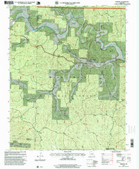
1997 Map of Fremont
USGS Topo · Published 1999About this map
Industrial history and Ozark wilderness converge in this survey of Fremont and the surrounding reaches of the Mark Twain National Forest. The map documents a specific legacy of the regional timber and iron industries, most notably the Site of Old Midco Iron Works situated along the winding drainage of Midco Creek. This area, once a center for charcoal iron production, is punctuated by relic infrastructure like the Old Tram Road, which snakes through the wooded hollows toward the Carter and Shannon County lines.
Find a feature on this map
36 named features on this map. Tap any name to fly to it.
Don’t see what you’re looking for? This feature index may not catch every label — zoom into the map to look around manually.
Map Details
Editions of this 1997 Fremont Map
This is the sole edition of this map. No revisions or reprints were ever made.
Other maps of this area

1915 · Eminence
USGS Topo · 1:62,500

1917 · Eminence
USGS Topo · 1:62,500

1928 · Cardareva
USGS Topo · 1:62,500

1931 · Bandyville
USGS Topo · 1:48,000

1944 · Van Buren
USGS Topo · 1:62,500

1944 · Birch Tree
USGS Topo · 1:62,500

1946 · Van Buren
USGS Topo · 1:62,500

1948 · Birch Tree
USGS Topo · 1:62,500

1949 · Rolla
USGS Topo · 1:250,000

1949 · Cardareva
USGS Topo · 1:62,500