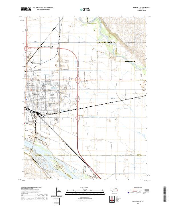
2021 Map of Fremont East
USGS Topo · Published 2021About this map
Fremont serves as the focal point of this Eastern Nebraska landscape, where the urban grid is defined by the Dodge County Courthouse and educational institutions like Midland College and La James International College. The city's southern boundary is shaped by its proximity to the BNSF Railway and the neighboring community of Inglewood. Outside the city center, the terrain is dominated by the complex hydrology of the Platte River and Elkhorn River basins. To the south, the riverside community of Woodcliff sits along the Platte, while the northern sections of the map show the meandering course of Rawhide Cr and its associated Rawhide Cr (Old Channel). This 2021 survey illustrates the transition from dense municipal development to the structured agricultural and recreational lands of the Mercer area, connected by an extensive network of county roads.
Find a feature on this map
117 named features on this map. Tap any name to fly to it.
Don’t see what you’re looking for? This feature index may not catch every label — zoom into the map to look around manually.
Map Details
Editions of this 2021 Fremont East Map
This is the sole edition of this map. No revisions or reprints were ever made.
Other maps of this area

1893 · Fremont
USGS Topo · 1:125,000

1896 · Fremont
USGS Topo · 1:125,000

1899 · Wahoo
USGS Topo · 1:125,000

1955 · Fremont
USGS Topo · 1:250,000

1957 · Fremont
USGS Topo · 1:250,000

1958 · Fremont
USGS Topo · 1:250,000

1966 · Nickerson
USGS Topo · 1:24,000

1966 · Hooper
USGS Topo · 1:24,000

1968 · Valley
USGS Topo · 1:24,000

1968 · Leshara
USGS Topo · 1:24,000