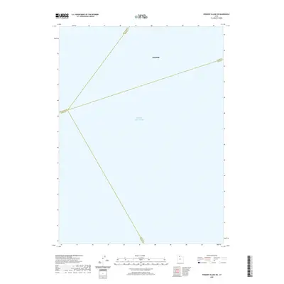
2020 Map of Fremont Island SW
USGS Topo · Published 2020About this map
Great Salt Lake dominates the majority of this geography, illustrating the expansive aquatic landscape west of the Wasatch Front. This particular reach of the lake is marked by the convergence of several major political boundaries, highlighting the complex administrative divisions that meet in the open water. The map traces the lines separating Box Elder, Weber, Davis, and Tooele counties as they intersect across the lake's surface. In the northern portion of the sheet, the settlement of Hooper appears along the shore, representing the interface between the established communities of Weber County and the vast, saline environment of the lake. This survey provides a precise modern look at the shoreline and county jurisdictions before they transition toward the more interior island features of the Great Salt Lake.
Find a feature on this map
6 named features on this map. Tap any name to fly to it.
Don’t see what you’re looking for? This feature index may not catch every label — zoom into the map to look around manually.
Map Details
Editions of this 2020 Fremont Island SW Map
This is the sole edition of this map. No revisions or reprints were ever made.
Other maps of this area

1885 · Tooele Valley
USGS Topo · 1:250,000

1953 · Tooele
USGS Topo · 1:250,000

1954 · Brigham City
USGS Topo · 1:250,000

1955 · Fremont Island
USGS Topo · 1:24,000

1955 · Tooele
USGS Topo · 1:250,000

1958 · Brigham City
USGS Topo · 1:250,000

1962 · Brigham City
USGS Topo · 1:250,000

1968 · Promontory Point
USGS Topo · 1:24,000

1968 · Plug Peak NW
USGS Topo · 1:24,000

1968 · Fremont Island SW
USGS Topo · 1:24,000