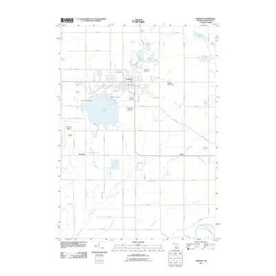
2011 Map of Fremont
USGS Topo · Published 2011About this map
Fremont serves as the central hub of this West Michigan landscape, where the residential grid meets industrial and agricultural interests. The city is flanked by a series of glacial water bodies, most notably the expansive Fremont Lake and a chain of smaller lakes to the north including First Lake, Second Lake, and Third Lake. To the south and east, the terrain transitions into a patchwork of drainage systems and creeks, such as Butler Creek and Minnie Creek, which eventually feed toward the Muskegon River in the southeast corner.
Find a feature on this map
87 named features on this map. Tap any name to fly to it.
Don’t see what you’re looking for? This feature index may not catch every label — zoom into the map to look around manually.
Map Details
Editions of this 2011 Fremont Map
This is the sole edition of this map. No revisions or reprints were ever made.
Other maps of this area

1931 · Walkerville SE
USGS Topo · 1:31,680

1954 · Milwaukee
USGS Topo · 1:250,000

1954 · Midland
USGS Topo · 1:250,000

1958 · Midland
USGS Topo · 1:250,000

1958 · Milwaukee
USGS Topo · 1:250,000

1958 · Hesperia
USGS Topo · 1:62,500

1958 · Twin Lake
USGS Topo · 1:62,500

1958 · Fremont
USGS Topo · 1:62,500

1959 · Midland
USGS Topo · 1:250,000

1959 · White Cloud
USGS Topo · 1:62,500