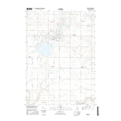
2017 Map of Fremont
USGS Topo · Published 2017About this map
Fremont sits at the heart of this Newaygo County landscape, characterized by a complex network of glacial lakes and managed drainage systems. Significant water bodies like Fremont Lake and the smaller Grandpa Lakes define the local geography, while a series of artificial channels, including Dunning Drain and Holmes Drain, illustrate the region's agricultural water management. To the north, a chain of smaller lakes such as First Lake through Fourth Lake creates a distinct corridor of wetlands and water. For genealogists and local historians, the map identifies several significant burial sites, most notably the Newago County Poor Farm Cem and Maple Grove Cem. The southern edge of the quadrangle is marked by the winding course of the Muskegon River, while the western periphery includes the Fremont Municipal Airport and the smaller settlement of Bishop.
Find a feature on this map
78 named features on this map. Tap any name to fly to it.
Don’t see what you’re looking for? This feature index may not catch every label — zoom into the map to look around manually.
Map Details
Editions of this 2017 Fremont Map
This is the sole edition of this map. No revisions or reprints were ever made.
Other maps of this area

1931 · Walkerville SE
USGS Topo · 1:31,680

1954 · Milwaukee
USGS Topo · 1:250,000

1954 · Midland
USGS Topo · 1:250,000

1958 · Midland
USGS Topo · 1:250,000

1958 · Milwaukee
USGS Topo · 1:250,000

1958 · Hesperia
USGS Topo · 1:62,500

1958 · Twin Lake
USGS Topo · 1:62,500

1958 · Fremont
USGS Topo · 1:62,500

1959 · Midland
USGS Topo · 1:250,000

1959 · White Cloud
USGS Topo · 1:62,500