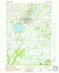
1985 Map of Fremont
USGS Topo · Published 1985About this map
Fremont Lake anchors this portion of Newaygo County, with the city of Fremont situated along its northern shores. The landscape is defined by a dense cluster of water bodies including Peck Lake, Ford Lake, and the numbered chain from First Lake to Fourth Lake. To the south, the Muskegon River cuts through the township of Ashland, marking a transition from the structured street grid of the city to more rural drainage patterns.
Find a feature on this map
52 named features on this map. Tap any name to fly to it.
Don’t see what you’re looking for? This feature index may not catch every label — zoom into the map to look around manually.
Map Details
Editions of this 1985 Fremont Map
This is the sole edition of this map. No revisions or reprints were ever made.
Other maps of this area

1931 · Walkerville SE
USGS Topo · 1:31,680

1954 · Milwaukee
USGS Topo · 1:250,000

1954 · Midland
USGS Topo · 1:250,000

1958 · Midland
USGS Topo · 1:250,000

1958 · Milwaukee
USGS Topo · 1:250,000

1958 · Hesperia
USGS Topo · 1:62,500

1958 · Twin Lake
USGS Topo · 1:62,500

1958 · Fremont
USGS Topo · 1:62,500

1959 · Midland
USGS Topo · 1:250,000

1959 · White Cloud
USGS Topo · 1:62,500