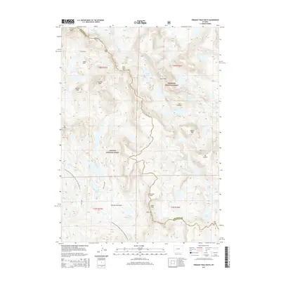
2015 Map of Fremont Peak South
USGS Topo · Published 2015About this map
The Continental Divide National Scenic Trail (Wyoming Portion) traverses the high-altitude crest of the Wind River Range, marking the boundary between the Bridger National Forest and the Shoshone National Forest. This 2015 survey documents a landscape defined by retreating ice and significant water systems, featuring the Bull Lake Glacier and Knife Point Glacier near the northern border. Peaks like Fremont Peak and Jackson Peak overlook a network of alpine drainage, including Pole Cr and the Middle Fork Bull Lake Cr. The map shows established backcountry infrastructure such as the Highline trail and the Cook Lake Loop, which provide access to fishing and exploration sites like Cook Lakes and Wall Lake. The transition from Indian Basin through Indian Pass and Angel Pass reflects the vital through-routes for modern-day hikers tracing the Continental Divide.
Find a feature on this map
45 named features on this map. Tap any name to fly to it.
Don’t see what you’re looking for? This feature index may not catch every label — zoom into the map to look around manually.
Map Details
Editions of this 2015 Fremont Peak South Map
This is the sole edition of this map. No revisions or reprints were ever made.
Other maps of this area

1909 · Fremont Peak
USGS Topo · 1:125,000

1938 · Mt Bonneville
USGS Topo · 1:62,500

1941 · Mt Bonneville
USGS Topo · 1:62,500

1942 · Mt Bonneville
USGS Topo · 1:62,500

1952 · Bob Lakes
USGS Topo · 1:24,000

1952 · Alpine Lake
USGS Topo · 1:24,000

1955 · Thermopolis
USGS Topo · 1:250,000

1955 · Lander
USGS Topo · 1:250,000

1958 · Lander
USGS Topo · 1:250,000

1958 · Thermopolis
USGS Topo · 1:250,000