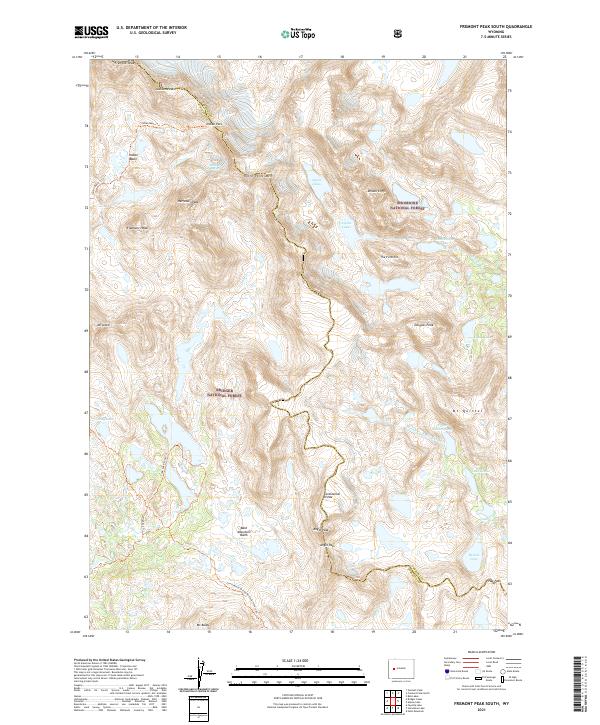
2021 Map of Fremont Peak South
USGS Topo · Published 2021About this map
The Continental Divide winds through the heart of this high-elevation landscape, marking the boundary between the Bridger National Forest and the Shoshone National Forest. This terrain is defined by extreme elevations, including the iconic Fremont Peak and the nearby Jackson Peak. Glacial activity is evident at the Harrower Glacier, feeding a complex network of alpine water bodies such as Snowbridge Lake, the Alpine Lakes, and Upper Golden Lake.
Find a feature on this map
40 named features on this map. Tap any name to fly to it.
Don’t see what you’re looking for? This feature index may not catch every label — zoom into the map to look around manually.
Map Details
Editions of this 2021 Fremont Peak South Map
This is the sole edition of this map. No revisions or reprints were ever made.
Other maps of this area

1909 · Fremont Peak
USGS Topo · 1:125,000

1938 · Mt Bonneville
USGS Topo · 1:62,500

1941 · Mt Bonneville
USGS Topo · 1:62,500

1942 · Mt Bonneville
USGS Topo · 1:62,500

1952 · Bob Lakes
USGS Topo · 1:24,000

1952 · Alpine Lake
USGS Topo · 1:24,000

1955 · Thermopolis
USGS Topo · 1:250,000

1955 · Lander
USGS Topo · 1:250,000

1958 · Lander
USGS Topo · 1:250,000

1958 · Thermopolis
USGS Topo · 1:250,000