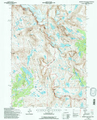
1991 Map of Fremont Peak South
USGS Topo · Published 1997About this map
The Continental Divide serves as the backbone of this high-altitude landscape, carving a boundary between the Shoshone National Forest and Bridger-Teton National Forest. Large ice masses, including the Bull Lake Glacier and Knife Point Glacier, cling to the northeast slopes of the Wind River Range, illustrating the glacial processes that have shaped these peaks. This 1991 field-checked survey highlights a transition into protected lands, with the Fitzpatrick Wilderness and Bridger Wilderness dominating the topography. Below the jagged summits of Knife Point Mountain and Harrower Peak, an intricate network of alpine water bodies like Wall Lake and Golden Lake feeds into the headwaters of Pole Creek and the Middle Fork Bull Lake Creek. Long-distance paths, notably the Fremont Trail and Highline Trail, provide the primary human access through this roadless high country, crossing strategic points such as Indian Pass and Angel Pass.
Find a feature on this map
44 named features on this map. Tap any name to fly to it.
Don’t see what you’re looking for? This feature index may not catch every label — zoom into the map to look around manually.
Map Details
Editions of this 1991 Fremont Peak South Map
This is the sole edition of this map. No revisions or reprints were ever made.
Other maps of this area

1909 · Fremont Peak
USGS Topo · 1:125,000

1938 · Mt Bonneville
USGS Topo · 1:62,500

1941 · Mt Bonneville
USGS Topo · 1:62,500

1942 · Mt Bonneville
USGS Topo · 1:62,500

1952 · Bob Lakes
USGS Topo · 1:24,000

1952 · Alpine Lake
USGS Topo · 1:24,000

1955 · Thermopolis
USGS Topo · 1:250,000

1955 · Lander
USGS Topo · 1:250,000

1958 · Lander
USGS Topo · 1:250,000

1958 · Thermopolis
USGS Topo · 1:250,000