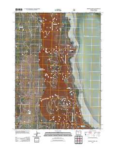
2011 Map of Fremont Point
USGS Topo · Published 2011About this map
Fremont Point overlooks the vast expanse of Summer Lake in this high-desert landscape of Lake County. The terrain is defined by dramatic elevation changes where the rim meets the lake basin, featuring landmarks like Brattain Hill and Hunter Hill. Water management in this arid region is visible through the infrastructure of Foster Reservoir and the smaller Little Ross Reservoir, which capture runoff from drainages such as Foster Creek and Benny Creek.
Find a feature on this map
13 named features on this map. Tap any name to fly to it.
Don’t see what you’re looking for? This feature index may not catch every label — zoom into the map to look around manually.
Map Details
Editions of this 2011 Fremont Point Map
This is the sole edition of this map. No revisions or reprints were ever made.
Other maps of this area

1955 · Klamath Falls
USGS Topo · 1:250,000

1958 · Klamath Falls
USGS Topo · 1:250,000

1966 · Summer Lake
USGS Topo · 1:24,000

1966 · Shake Butte
USGS Topo · 1:24,000

1966 · Slide Mtn
USGS Topo · 1:24,000

1966 · Harvey Creek
USGS Topo · 1:24,000

1966 · Fremont Point
USGS Topo · 1:24,000

1966 · Pole Butte
USGS Topo · 1:24,000

1966 · Foster Butte
USGS Topo · 1:24,000

1974 · Lake Abert
USGS Topo · 1:100,000