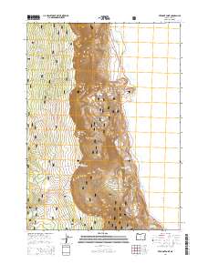
2014 Map of Fremont Point
USGS Topo · Published 2014About this map
Fremont National Forest dominates the high desert terrain of southern Oregon, where the dramatic escarpment of Winter Ridge drops toward the basin floor. This 2014 survey captures the varied topography of Lake County, featuring significant landmarks like Fremont Point and the geological formation known as The Punchbowl. The landscape is a mix of high plateaus and alluvial flats, including Big Flat and Bennett Flat, intersected by the Fremont Hwy. Water resources, essential for this arid environment, are mapped in detail through features such as Foster Reservoir, Little Ross Reservoir, and Squirrel Spring. The presence of several forest development roads, including Natl Forest Develop Road 290 Rd, highlights the managed nature of these timberlands. The eastern edge of the quadrangle touches the shoreline of Summer Lake, providing a clear view of the transition from forested heights to the expansive lake basin.
Find a feature on this map
21 named features on this map. Tap any name to fly to it.
Don’t see what you’re looking for? This feature index may not catch every label — zoom into the map to look around manually.
Map Details
Editions of this 2014 Fremont Point Map
This is the sole edition of this map. No revisions or reprints were ever made.
Other maps of this area

1955 · Klamath Falls
USGS Topo · 1:250,000

1958 · Klamath Falls
USGS Topo · 1:250,000

1966 · Summer Lake
USGS Topo · 1:24,000

1966 · Shake Butte
USGS Topo · 1:24,000

1966 · Slide Mtn
USGS Topo · 1:24,000

1966 · Harvey Creek
USGS Topo · 1:24,000

1966 · Fremont Point
USGS Topo · 1:24,000

1966 · Pole Butte
USGS Topo · 1:24,000

1966 · Foster Butte
USGS Topo · 1:24,000

1974 · Lake Abert
USGS Topo · 1:100,000