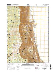
2017 Map of Fremont Point
USGS Topo · Published 2017About this map
Winter Ridge dominates the western half of this terrain, dropping sharply toward the expansive basin of Summer Lake to the east. This section of the Fremont National Forest is defined by its dramatic verticality, where the Southern Oregon Intertie Trail follows the high spine of the ridge past Fremont Point and The Punchbowl. The landscape transitions from the forested heights down through Hunter Hill Pass to the flats bordering the lake.
Find a feature on this map
21 named features on this map. Tap any name to fly to it.
Don’t see what you’re looking for? This feature index may not catch every label — zoom into the map to look around manually.
Map Details
Editions of this 2017 Fremont Point Map
This is the sole edition of this map. No revisions or reprints were ever made.
Other maps of this area

1955 · Klamath Falls
USGS Topo · 1:250,000

1958 · Klamath Falls
USGS Topo · 1:250,000

1966 · Summer Lake
USGS Topo · 1:24,000

1966 · Shake Butte
USGS Topo · 1:24,000

1966 · Slide Mtn
USGS Topo · 1:24,000

1966 · Harvey Creek
USGS Topo · 1:24,000

1966 · Fremont Point
USGS Topo · 1:24,000

1966 · Pole Butte
USGS Topo · 1:24,000

1966 · Foster Butte
USGS Topo · 1:24,000

1974 · Lake Abert
USGS Topo · 1:100,000